Need some help with navigating the Mapping Little Rock History site or effectively using a feature? Just click on one of the questions below to find an answer.
For additional help, visit the Tips & How-to's page.
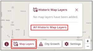
- Click Map Layers in the bottom-right corner, and select All Historic Map Layers. The side panel displays historic maps.
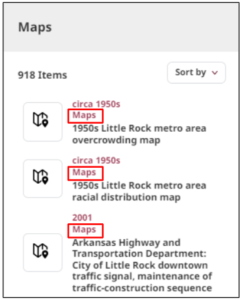
- All historic maps are labeled as Maps. Select the desired map from the results.
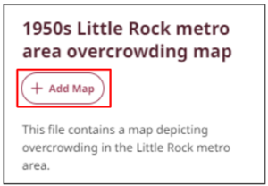
- Select Add Map. The historic map overlays on the current map.
- Make the map more or less opaque by sliding the opacity dial left or right.
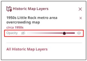
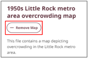
- Select Remove Map to remove the overlay.

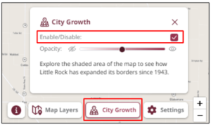
- Press the City Growth button in the bottom right corner. A pop-up box displays.
- Select the Enable/Disable checkbox to activate the feature. The annexed areas display.
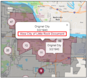
- Hover the mouse over an area to see the name of the territory and when it was annexed.
- Click an area—the View City of Little Rock Document pop-up window displays.
- Click View City of Little Rock Document. A new tab with documents from the annexation opens in the city’s site.
- Once you’re done exploring, press the City Growth button in the bottom-right corner and select the Enable/Disable checkbox to turn off the feature.
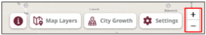
- Press the +/- icons in the screen’s bottom-right corner to zoom in or out, respectively.
Tip: You may also zoom in or out using a trackpad or mouse wheel. Additionally, you can zoom in to an area by double-clicking on it; however, this method does not allow you to zoom out.
You can download any artifact in the archive.
To download a photograph or architectural drawing:
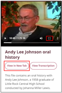
- Press the Maximize icon or View in New Tab. The artifact enlarges.
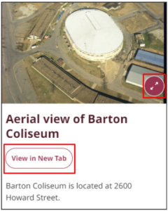
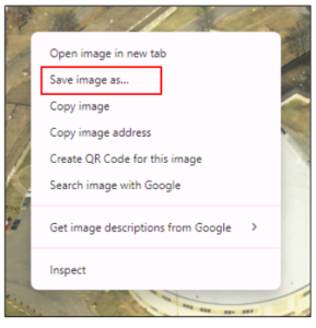
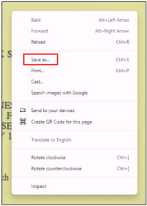
- Right-click the artifact and a menu displays. Select Save image as.
Note: Your device may use a different phrase for saving documents, such as Save to Photos. Select the appropriate option for your device.
- Input the desired file name, and select Save.
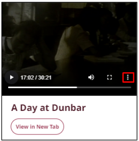
To download a video or audio recording:
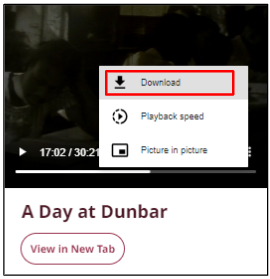
- Click the three dots on the right of the artifact. A pop-up menu displays.
- Select Download. The file automatically downloads to your device.
To download a document:
- Select View in New Tab. The document opens in a new tab.
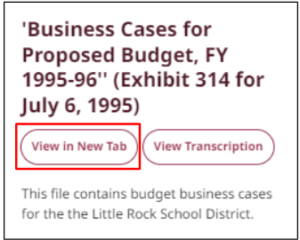
- Right-click the artifact and a menu displays. Select Save as.
Note: Your device may use a different phrase for saving documents, such as Save to Files. Select the appropriate option for your device.
- Input the desired file name, and select Save.
To download a historic map:
- Navigate to the Map Downloads page in the help center.
- Click the link of the map you want to download.
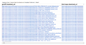
- The map automatically downloads to your device.
To maximize a photograph or architectural drawing:
- Select the expand icon in the bottom-right corner of the photograph or drawing. The artifact enlarges and centers on the screen.
– OR –
Select View in New Tab. The artifact enlarges and opens in a new tab.
To maximize a video:
- Select the fullscreen icon in the bottom-right corner of the video. The artifact enlarges and fills the screen.
– OR –
Select View in New Tab. The artifact enlarges and opens in a new tab.
To maximize a document:
- Select View in New Tab. The entire document opens in a new tab.
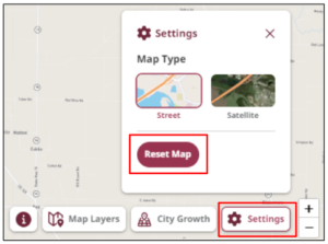
There are two ways to reset the map: via the side panel or on the main screen.
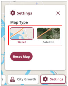
- Select Settings in the bottom-right corner of the main screen, and then select Reset Map. The map clears your progress and reverts back to its original setting.
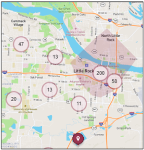
Maroon Circle: a cluster of pins
Number within Circle: the number of pins within the cluster
Maroon Pin: a specific location
Maroon Shape: the area in which the pins are located
There are two map types you can use to view the current map: street and satellite. To change the map type:
- Select Settings in the bottom-right corner of the screen. A pop-up box displays.
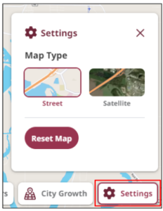
- Select your preferred map type: Street or Satellite. The map updates to reflect your selection.
*Note: The Mapping Little Rock History website is the product of a National Endowment for the Humanities grant project called Mapping Urban Fracture. These two names are used interchangeably throughout this site.