Technology and Life in Arkansas – Object #4

Arkansas Power and Light Company Preferred Stock sales brochure, Page 7
Download Map

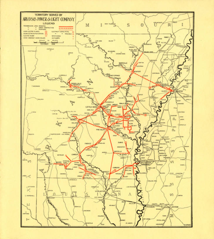
<p>The image is a line drawing map of the state of Arkansas, with red thick lines indicating completed power lines, and dashed lines indicating proposed lines. The map shows some access to electrical power south of a line running from the northeast to the southwest corner of the state, but almost no electricity in the mountainous portions of the state.</p>

A map showing electrical power lines completed, under construction and under consideration in Arkansas in 1927 along with other services such as ice plants.

Questions:
Where are power lines and planned power lines concentrated?
What do these areas tend to have in common?
How might daily life and business activity be different in areas with no electricity?

Citations

Arkansas Power and Light Sales Brochure, Page 7, Map: Territory Served by Arkansas Power & Light Company –1927. Butler Center for Arkansas Studies mss_0616_0101_0317_007