A map exhibiting all the new discoveries in the interior parts of North America, 1802
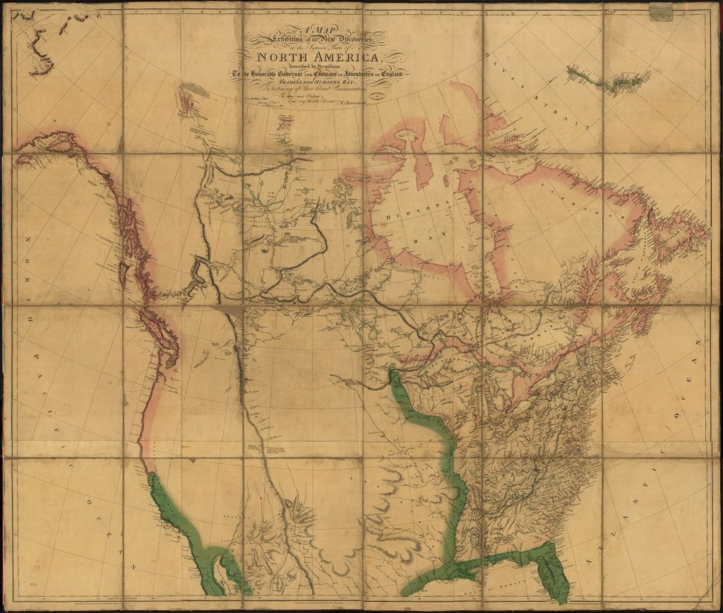
This map shows the topography of the United States as it was known in 1802, as well as adjacent territories now part of the United States.
Questions:
Why was this map created? List evidence from the map to support your answer.
How does this map help us understand the survey of Louisiana in 1815?
Why is the area to the east of the Mississippi River full of topographical features, but the western part is essentially blank?
What did you find out about from this map that you might not learn from another type of source?