Original survey notebooks of Joseph C. Brown, deputy United States surveyor, who surveyed the baseline, and Prospect K. Robbins, who surveyed the fifth principal meridian, undated
Download Photograph of survey notebooks
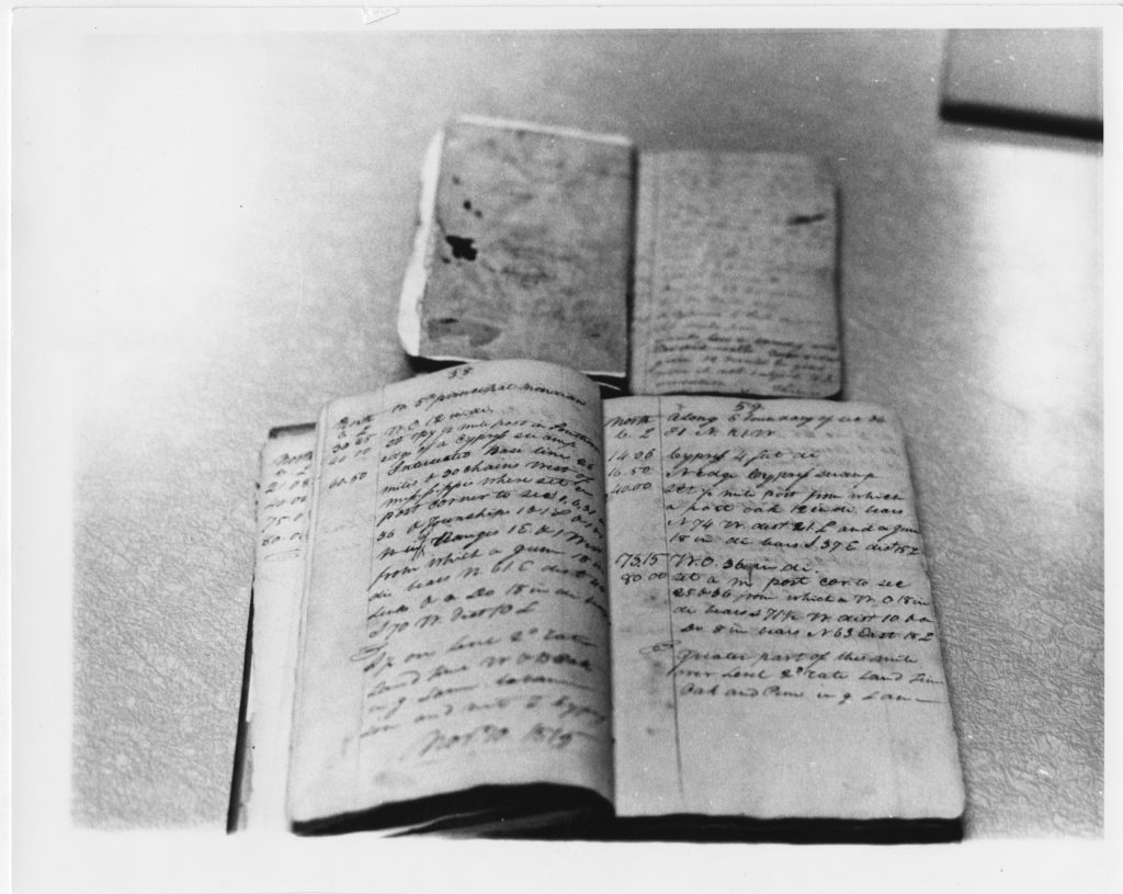
Photocopy of original survey notebooks of Joseph Brown, Deputy U.S. Surveyor, who surveyed the base line (bottom) and P.R. Robbins who surveyed the fifth principal meridian (top).
Transcript
P. 58
Intersected base line 26 miles & 20 chains west of Mississippi where set in post corner to ….
P. 59
14.06, 16.50, 40.00 Cypress ..N. edge by prev. Swamp set ½ mile post from which a post oact 12 in wide bears N. 74 W. dist. 21 L. and a gum 18 in di. Bears (?) S. 37 E. dist 15 L…
Questions:
How do you think people surveyed land back in 1815? How do you think land is surveyed now?
What do you think the numbers in the journals mean? Why are there descriptions next to the numbers?
How would you keep these journals safe and dry while surveying?
What do you think the authors of these journals felt about walking the entire width/ length of the Arkansas in order to survey the land? What challenges might the surveyors have faced?