America noviter delineata
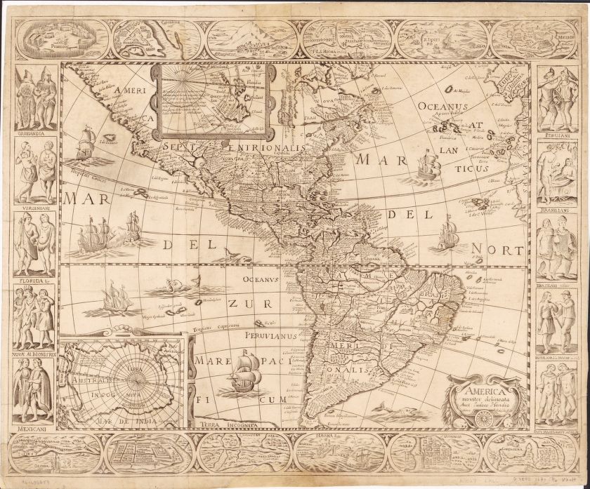
World map from 1670. Relief shown pictorially. Includes insets of north and south polar regions, and ill. of native figures and town views in margin. Prime meridian: Ferro.
Questions:
What do you notice about the language of the map?
Why do you think the map was drawn?
Could an explorer use this map? Is this map accurate?
What type of physical geography and landforms does this map show in the Americas? How would these landforms affect the way people lived?