Map showing the lands assigned to emigrant Indians west of Arkansas and Missouri, 1836
Click here for a zoomed version of the map showing the land assignments
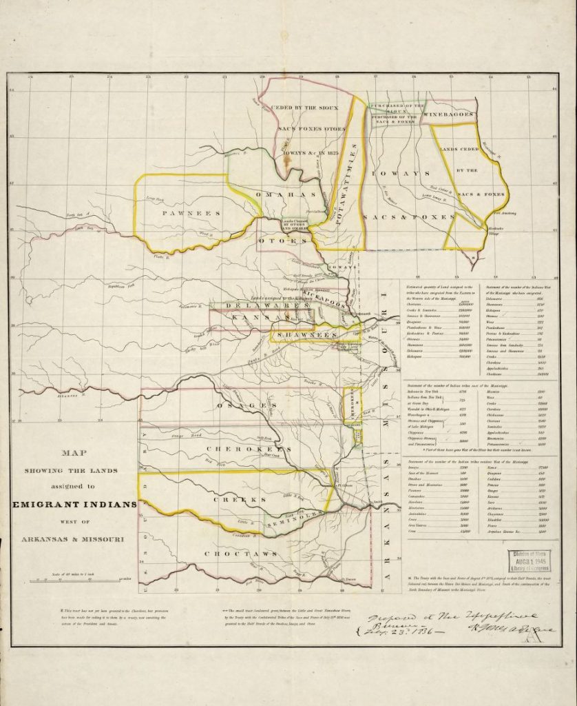
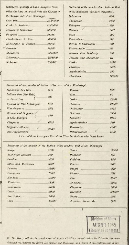
1836 Map showing the lands assigned to native groups, including the Choctaw, Cherokee, Creek, Osage, Quapaw, Shawnee, Pawnee, Otoes, Delaware, Kickapoo, Kansas, Potawatamies, Omaha, Sacs & Foxes west of Arkansas and Missouri. Forts along the major roads are also shown, including Ft. Smith, Arkansas.
Questions:
How many native groups were moved into the territory west of Arkansas and Missouri?
Which groups were the largest?
What current day landmarks do you see on this map?
From what perspective was this map drawn, or who do you think drew this map? Give evidence to support your answer.
How might this map look different if it was drawn from a different perspective? Why?