American Indian Removal – Object #5

Map of the former territorial limits of the Cherokee Nation of Indians , 1884

Download map

Click here for a zoomed in section that shows the Schedule of Cherokee Cessions

<p>The map shows land in current-day North Carolina, South Carolina, Georgia and Tennessee in 36 different divisions, each representing a different treaty or action in which the Cherokee interacted with colonies or the United States, resulting in their loss of land.</p>

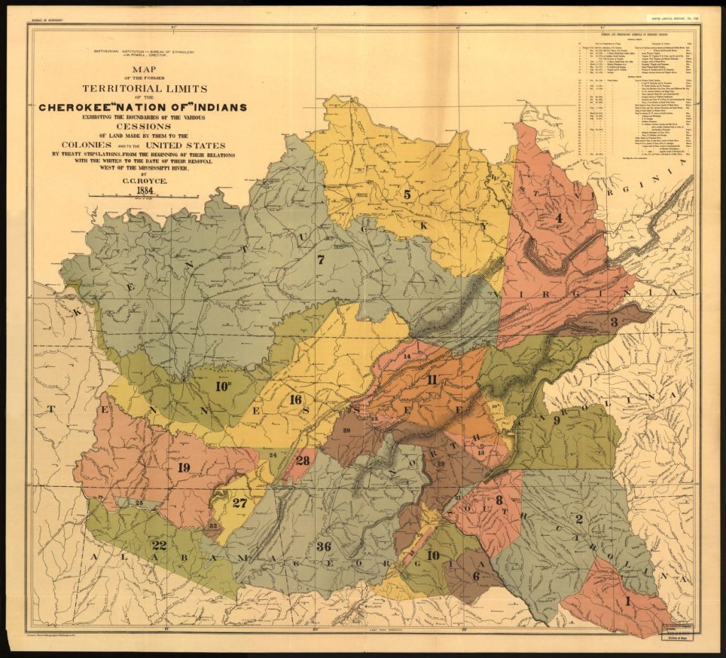
This map shows land formerly claimed by the Cherokee, which was either signed over to colonies or the U.S. by treaty, or taken after the Indian Removal Act.

Questions:  

What does the word “ceded” mean?

Compare this map with the map from 1836 showing territory west of Arkansas and Missouri. What do you notice?

From what perspective was this map drawn? Cite evidence to support your answer.

Citations

Royce, C. C. Map of the former territorial limits of the Cherokee “Nation of” Indians ; Map showing the territory originally assigned Cherokee “Nation of” Indians. [S.l, 1884] Map. Library of Congress Geography and Map Division.