North Carolina, South Carolina with special maps of Great Smokies and Southeast United States, 1958
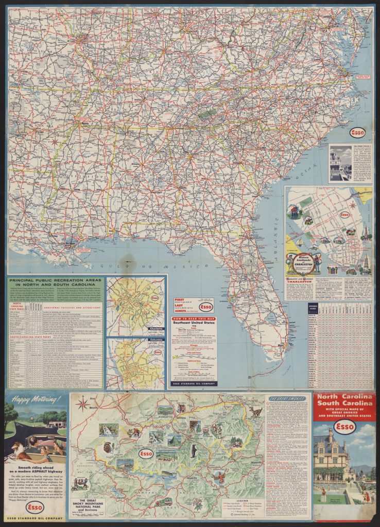
The Esso tourist map from 1958 shows highways, rivers and lakes, and major cities in the Southeast United States.
Excerpts
From bottom left: “Happy Motoring! The miles just seem to float by when you travel on quiet, safe, easy-to-drive highways…And it’s always reassuring to know that wherever you drive–from Maine to Louisiana–you are never far from an Esso dealer who is in business to serve you for Happy Motoring!”
Questions:
What kind of source is this?
Where is Little Rock on this map?
Where is Lake City, South Carolina, where Ron lived in the 1950s when this map was made?
Do you think it would take a long time to drive from Little Rock to Lake City? Give evidence to support your answer.
In what part of the country is Lake City, South Carolina, located?