Dunbar-Hunter Expedition – Object #4

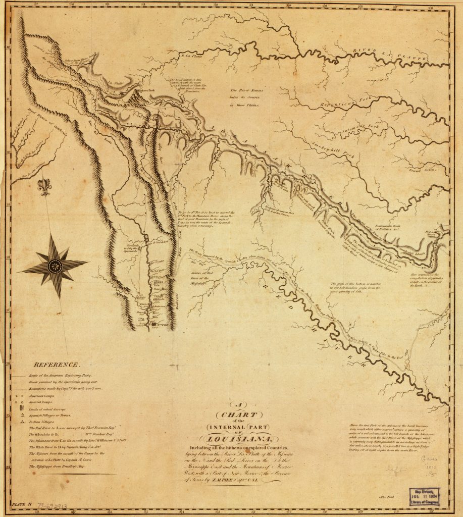
A Chart of the Internal Part of Louisiana
Download Map

<p>From the bottom to the top, the Red River, Arkansas River and Platte River are featured on this map. They run northwest to southeast across the map. On the left side of the map are the pueblos of New Mexico. Mountains that must be passed to cross west are also shown.</p>

1810 Map of the Interior of the United States west of the Mississippi to New Mexico

Questions:

What rivers and landmarks do you observe on this map? How do they compare with the physical geography mentioned in the journals?

What differences do you notice about this map, as compared to maps today?

Who might have created this map? For what reason? Who do you think was the audience for the map? Cite evidence to support your answer.

Citations

Pike, Zebulon Montgomery, and Anthony Nau. A Chart of the Internal part of Louisiana…[Philadelphia, 1810] Library of Congress Geography and Map Division.