Virginia
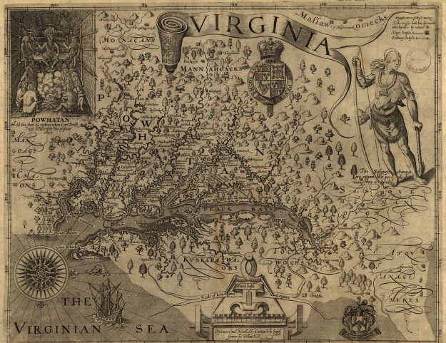
1624 map of Virginia – based on information from John Smith and William Hole
Questions
Who contributed to this map? How did they view Virginia based on the details of this map?
How does this map show its creators’ perspective?
In what ways do you think this map has changed over time?
If you were Samuel, what would be your opinion of Virginia based on this map?
Citations
Smith, John, and William Hole. Virginia. [London, 1624] Map.