
Transcript of pamphlet regarding the McClellan-Kerr Arkansas River Navigation System
THE McCLELLAN-KERR ARKANSAS RIVER NAVIGATION SYSTEM
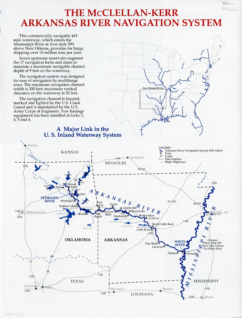
This commercially navigable 445 mile waterway, which enters the Mississippi Rive at river mile 599 above New Orleans, provides for barge shipping over 10 million tons per year.
Seven upstream reservoirs augment the 17 navigation locks and dams to maintain a maximum navigable channel depth of 9 feet on the waterway.
The navigation system was designed for ease of navigation by multibarge tows. The maximum navigation channel width is 300 feet; maximum vertical clearance on the waterway is 52 feet.
The navigation channel is buoyed, marked and lighted by the U.S. Coast Guard and is maintained by the U.S. Army Corps of Engineers. Tow haulage equipment has been installed at locks 3, 4, 5 and 6.
A Major Link in the U. S. Inland Waterway System