How does physical geography affect culture?
Subject(s): Geography, Native Americans, and US History
Time Period(s): (1585-1783) Colonization and Settlement and (Beginnings To 1620) Three Worlds Meet
Grade level(s): 3-5
Click here to download the powerpoint
It is difficult to study American Indian cultures prior to contact with Europeans because of the lack of primary sources. The main sources for understanding this period come from archaeologists who have unearthed items like pottery and tools, as well as oral tradition from present-day American Indian cultures. In addition, some structures like mounds and adobe buildings in the American Southwest still stand in our current landscape. This primary source set uses images from the late 19th and early 20th century to look at American Indian cultural regions. It is important to note that cultures change over time, and that these sources are an incomplete way of trying to understand what American Indian cultures might have been like prior to contact with Europeans. Recommended reading for this topic is Anthony Aveni, The First Americans, illustrated by S.D. Nelson.
Supporting question(s):
How were American Indians similar and different from each other in terms of housing, dress, and daily life? From people today?
Where did early Native Americans settle and how did physical features affect their settlements?
How did geographical and environmental factors impact how American Indians lived?
What resources did the people in each region use to meet their daily needs including food, shelter, clothing and tools?
How did the Native Americans in each region interact with their physical environment to meet their needs?
What were some of the major cultural differences between nomadic/semi-sedentary and sedentary groups?
Source Set
- Petroglyphs at Utah’s Newspaper Rock
- America noviter delineata
- Village of Secotan
- Birch-bark Indian Wigwams
- Camp at Stony Lake
- A Street -- Pueblo of Zuni
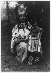
- Cayuse Woman and Child
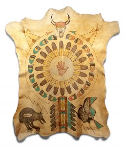
- Momaday Elk Hide Painting
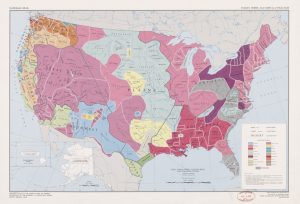
- National Atlas. Indian tribes, cultures & languages
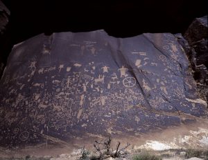
Description
Prehistoric people left records on this rock near a spring in San Juan County, Utah.
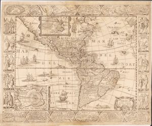
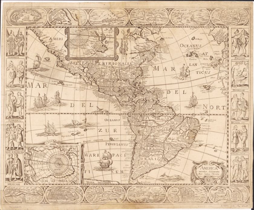
Description
World map from 1670. Relief shown pictorially. Includes insets of north and south polar regions, and ill. of native figures and town views in margin. Prime meridian: Ferro.
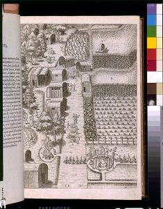
Description
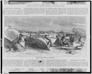
Algonquian village on the Pamlico River estuary (Virginia) showing Native structures, agriculture, and spiritual life. The engraving, an illustration in the book Americae pars decima (1619), was made from a drawing by John White, ca. 1585-1593.
Description
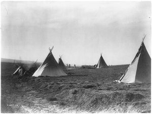
Wood engraving of American Indians near Lake Superior in camp with birch bark wigwams and a canoe
Description
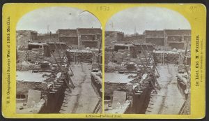
Stereographic print card of Zuni pueblo showing multistory buildings and pottery.
Description
Contemporary native painting on an elk hide in the style of historic hide paintings
Description
National atlas of American Indian cultural and linguistic groups found in the United States
Additional resource(s):
Smithsonian National Museum of the American Indian – Common Misconceptions
Additional images:
Photograph of Oak Tree House, Mesa Verde, from the Denver Public Library
Arkansas Framework(s):
Arkansas Social Studies Frameworks (Grade 5)
H.12.5.2 Compare characteristics (e.g., dwellings, culture, beliefs, land use, food, clothing) of major pre-Columbian people groups within North America using a variety of sources (e.g., mound builders, cliff dwellers, Southwest, Great Plains, Pacific Northwest, Woodland peoples)
H.12.5.1 Develop claims about pre-Columbian societies in North America by analyzing artifacts, artwork, charts, graphs, digital, and print sources