Why survey a swamp?
Subject(s): Arkansas History, Geography, and US History
Time Period(s): (1801-1861) Expansion and Reform
Grade level(s): 6-8
Click here to download the powerpoint
Following the War of 1812, President James Monroe ordered the surveying of the Louisiana Purchase, which had been added to the United States in 1803, but not fully surveyed. Prospect Robbins and Joseph Brown completed the survey, beginning with the Fifth Meridian. Their survey is the foundation of land subdivisions into sections, townships and ranges. The initial survey point, commemorated today at Louisiana Purchase State Park, is located in Monroe County, Arkansas.
Supporting question(s):
Why was Arkansas surveyed?
How was the survey accomplished?
Why was the survey important?
Source Set
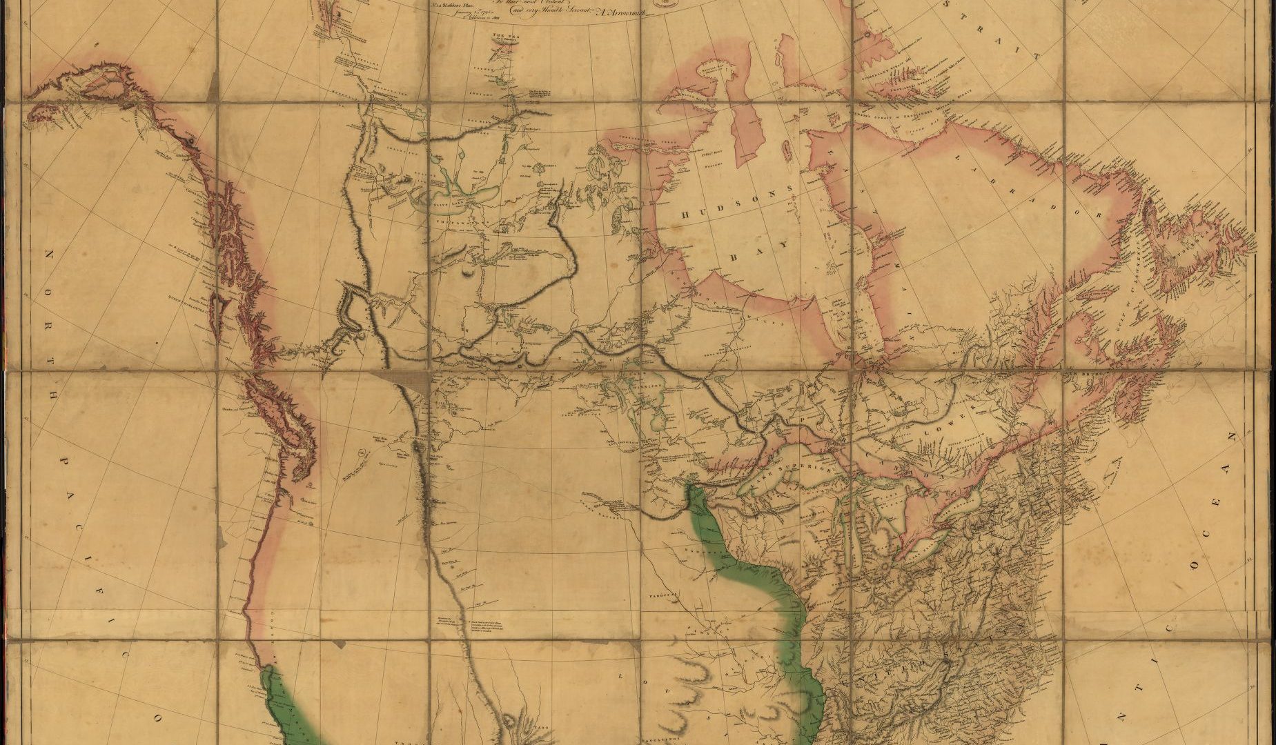
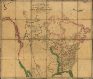
- A map exhibiting all the new discoveries in the interior parts of North America, 1802
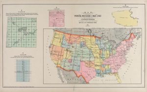
- Map Showing the Principal Meridians and Base Lines in the United States, 1913
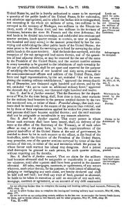
- An Act to Provide for Designating, Surveying, and Granting Military Bounty Lands.
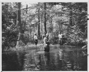
- In the middle of this Eastern Arkansas swamp is the Louisiana Purchase Monument sitting at the point where the baseline party and the fifth principal meridian party crossed on November 10, 1815 [photo dated July 11, 1967]
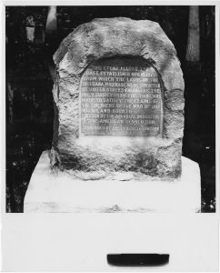
- Louisiana Purchase survey historical marker, undated
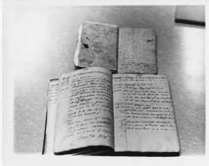
- Original survey notebooks of Joseph C. Brown, deputy United States surveyor, who surveyed the baseline, and Prospect K. Robbins, who surveyed the fifth principal meridian, undated
Description
This map shows the topography of the United States as it was known in 1802, as well as adjacent territories now part of the United States.
Description
Map of the principal meridians and base lines surveyed in the United States, 1911, with inserts of townships, sections, and the plan of numbering townships from meridians and base lines.
Description
An Act to Provide for Designating, Surveying, and Granting Military Bounty Lands passed by the 12th Congress, 1812, ch. 77. It led to the surveying of Michigan and Illinois territories and the Louisiana territory so that veterans of the War of 1812 could be paid in land.
Description
Photograph of a group of people in the swamp of Monroe County, Eastern Arkansas, around the marker commemorating the Louisiana Purchase survey.
Description
This photograph shows the historical marker erected in Monroe County, Eastern Arkansas, in what is currently Louisiana Purchase State Park.
Description
Photocopy of original survey notebooks of Joseph Brown, Deputy U.S. Surveyor, who surveyed the base line (bottom) and P.R. Robbins who surveyed the fifth principal meridian (top).
Additional resource(s):
Richard Elgin, “The Initial Point of the 5th Principal Meridian”
Encyclopedia of Arkansas Entry
Arkansas Frameworks(s):
ERA 4.1.8.1 Analyze multiple factors that affected territorial expansion and influenced the perspectives of people.
ERA 4.1.8.3 Examine economic, political, and geographic causes and effects of territorial expansion.
ERA 4.1.8.4 Analyze purposes, implementation, and effects of public policies.
ERA 4.1.8.6 Evaluate the historical significance of individuals, groups and events.